
The Flood Alert Gap
What is the flood alert gap?
The flood alert gap is the difference between the flooding the UK's free warnings cover and the flooding that actually causes most losses. Free government flood warnings cover river and coastal flooding only. Surface water flooding, the source of the majority of UK floods, sits outside that cover, so for most properties the first sign of a surface water flood is the water arriving. This guide explains where the gap comes from, who it affects, and how property-level forecasting closes it.
Updated October 21, 2026
Why It Exists
Why the flood alert gap exists
Built for rivers and the coast
Free national warnings were built around large river systems and the coast, where gauges and models give reliable notice.
Surface water is harder to model
Surface water (pluvial) flooding is faster, more local and harder to model at national scale, so it has historically sat outside routine warning cover.
A coverage gap, not a failure
This is a matter of coverage and modelling scope, not of any agency failing.
Surface water: the flooding most warnings miss
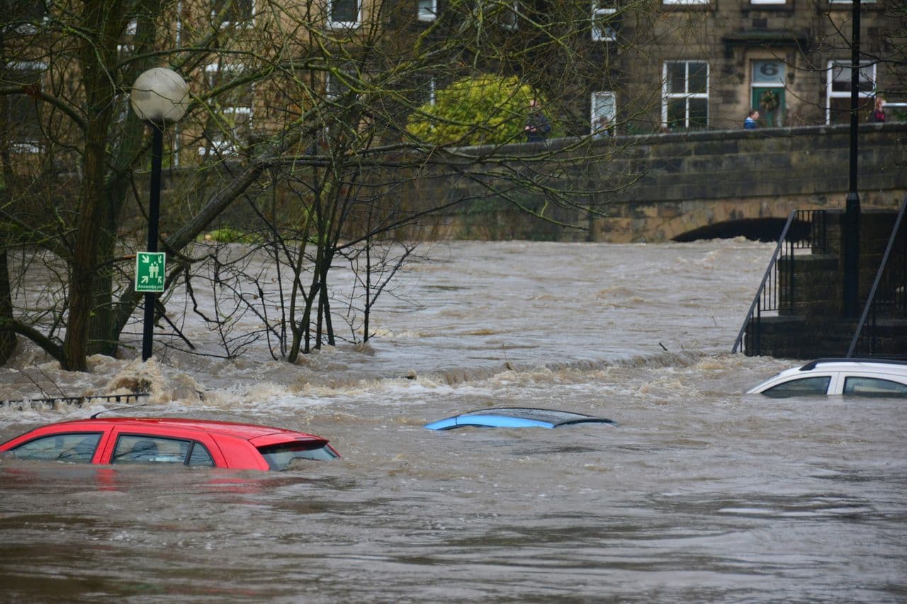
Surface water flooding happens when intense rainfall overwhelms drainage before it reaches a river, increasingly common as rainfall intensifies and land is built over. It is the single largest source of UK flood risk by properties exposed.
Coverage
Does the Environment Agency warn about surface water flooding?
- What the free warnings cover
- Is Flood Zone 1 safe from surface water flooding?
Looking Ahead
Notice, and what is coming nationally
How much notice do flood warnings give?
Official warning notice varies by flood type and source; Previsico provides property-level surface water alerts up to 48 hours ahead.
Read more: How much notice do flood warnings give?When will national surface water warnings arrive?
National surface water forecasting is advancing, with a phased Flood Forecasting Centre programme arriving later this decade. It complements, not replaces, the property-level alerts available today.
Read more: When will national surface water warnings arrive?What the flood alert gap costs
When surface water arrives with no notice, there is no time to move assets or protect a site, so the loss is larger than it needs to be. The financial scale of UK flooding to business is set out in our Cost of Flooding guide.
The Previsico Answer
How to close the flood alert gap
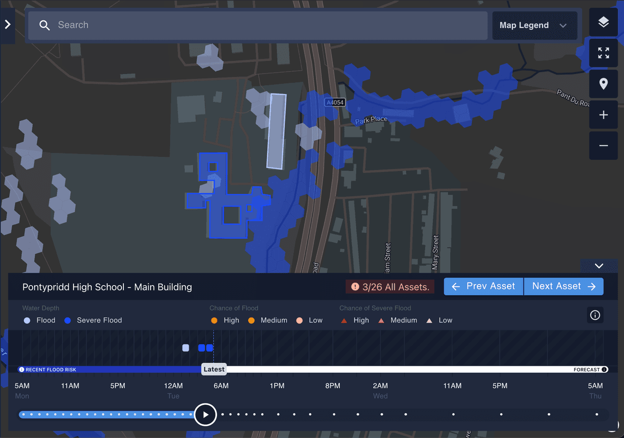
Live, property-level surface water forecasting
Property-level surface water forecasting fills the gap the free warnings leave: likelihood, severity and timing per asset, refreshed hourly, up to 48 hours ahead, from the peer-reviewed FloodMap+ engine developed over two decades at Loughborough University (Nature, Nature Water).
Solutions by sectorThe Numbers
Key numbers behind the flood alert gap
Surface water is the source of the majority of UK floods (Environment Agency).
Up around 43% on the previous assessment (EA National Assessment of Flood Risk, NaFRA2, 2024).
Covered by the Environment Agency's free river and coastal flood warnings.
Previsico's alerts reach organisations up to 48 hours ahead (product specification).
Frequently asked questions
Straight answers to the questions readers ask most about the flood alert gap.
The flood alert gap is the difference between the flooding the UK's free warnings cover (rivers and the coast) and the flooding that causes most losses (surface water). Property-level surface water forecasting closes that gap with alerts up to 48 hours ahead.
The Environment Agency's free warnings cover rivers and the sea. Surface water flooding is forecast nationally rather than warned for at individual properties. Read the full answer.
Notice varies by flood type and source. Previsico provides property-level surface water alerts up to 48 hours ahead, refreshed hourly. See how lead times compare.
Not necessarily. Flood Zone 1 reflects low river and coastal risk, but Flood Zones do not map surface water risk, so a Flood Zone 1 property can still flood from surface water. Read the full answer.
National surface water forecasting is progressing through a phased Flood Forecasting Centre programme arriving later this decade, complementing the property-level alerts available today. Read the full outlook.
Close the gap for your own sites.
Property-level surface water forecasting turns the flood alert gap into time to act, for a single site or a whole portfolio.
Related reading:
- Does the Environment Agency warn about surface water flooding?
- How much notice do flood warnings give?
- Surface water flooding in the UK
- When will national surface water warnings arrive?
- The Cost of Flooding to UK Business
Last updated August 2026.