
Flood Alert Gap
When will national surface water warnings arrive?
National surface water flood forecasting is advancing through the Flood Forecasting Centre, a Met Office and Environment Agency partnership, and is being improved in phases over the coming years. It's welcome progress at the national scale. It complements, rather than replaces, the property-level operational alerts organisations need to act on a specific site today.
Updated October 21, 2026

What is national surface water forecasting?
The Flood Forecasting Centre (Met Office + Environment Agency) produces the daily Flood Guidance Statement and national surface water risk forecasting for emergency responders. It gives an area-level national picture of where surface water flooding is likely.
The national picture
How national surface water forecasting is improving
Investment is improving the resolution and lead time of national surface water forecasting in phases over the coming years, genuine, welcome progress at the national scale.
Better resolution, longer lead time
National programmes are working to sharpen the accuracy and timing of surface water forecasts, building on the daily Flood Guidance Statement.
Built for responders, not individual properties
National forecasting is designed to support emergency responders and area-level planning, not to tell a specific property owner that their site will flood.
Today, and alongside
Why property-level alerts matter today, and alongside
An area-level national forecast tells a region flooding is likely; it doesn't tell a specific business whether its site will flood, or exactly when.
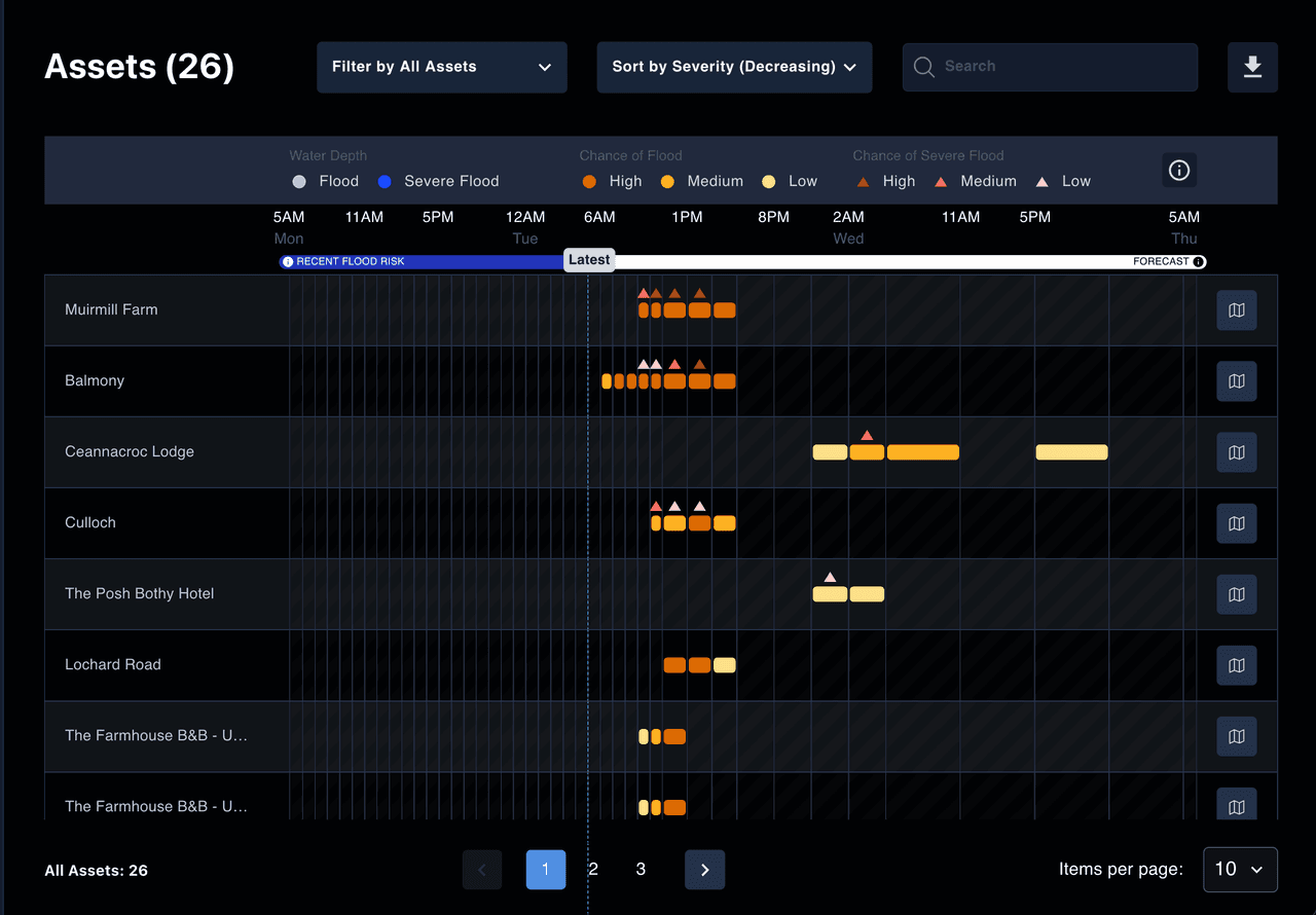
See risk down to the asset, not just the area
Previsico's property-level forecasts show likelihood, severity and timing per asset, up to 48 hours ahead, refreshed hourly, so you know exactly which sites need attention.
Works alongside the national picture as it improves
Previsico's operational alerts complement national surface water forecasting today, and continue to add value as the national programme advances.
Questions about national surface water forecasting
Straight answers to how national progress and Previsico's alerts fit together.
National surface water forecasting is advancing through the Flood Forecasting Centre, a partnership between the Met Office and the Environment Agency, with improvements planned in phases over the coming years. It's genuine progress at the national scale, and it complements rather than replaces the property-level alerts organisations need today.
No. National forecasting gives an area-level picture of where surface water flooding is likely, built for emergency responders and regional planning. A property-level alert tells you whether a specific site is likely to flood, and roughly when, so you can act on that one asset.
National surface water forecasting is designed for responders and area-level planning, not for warning an individual property owner. If you need to know whether a specific site will flood and when, a property-level operational alert gives you that today, alongside the improving national picture.
The Flood Forecasting Centre runs national surface water forecasting. It's a partnership between the Met Office and the Environment Agency, and it also produces the daily Flood Guidance Statement for emergency responders.
Get property-level alerts for your sites now.
See how Previsico's property-level alerts work alongside the improving national picture, live, site-specific, and ready today.
Last updated August 2026. Part of The Flood Alert Gap series.
No obligation.