
Insurers
Reduce flood claims before they happen.
Property-level flood forecasting and live monitoring that improves risk management, strengthens client relationships and supports underwriting, 48 hours before water arrives.
See your own sites on the platform. No obligation.
Trusted by insurers
Chosen by specialty insurers to protect their commercial clients.





The flood challenge for insurers
Flood is a top loss driver you still can't see coming.
Flood is niche but disproportionately expensive.
A top loss driver, yet carriers lack real-time visibility. Underwriting risk scores don't translate into live warnings, especially for surface water, which is harder to predict and where losses often land.
Climate change makes flood risk hard to predict.
Even the best projection models can miss fast-developing flash floods, events that only become visible through live radar rainfall data as they unfold.
Response is reactive, and value beyond the policy is hard to prove.
Flood response triggers only after impact, or is applied too broadly, such as a blanket excess across a whole book when only a handful of sites carry real exposure, wasting resources on the rest. Customers won't engage with yet another platform, so it's hard to prove ongoing value as a risk partner, not just a payer of claims.
Built for mitigation
Accurate, actionable alerts, delivered two ways.
Two technologies deliver the alert. A third gives you the confidence to act on it across every asset in the book.
Advance alerts your policyholders can act on.
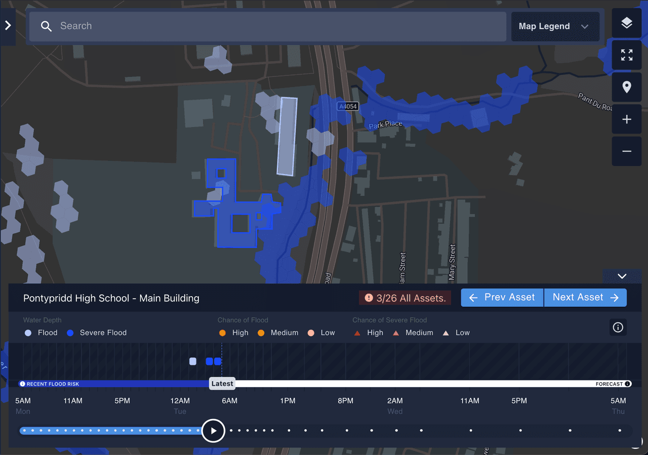
Property-level surface-water flood alerts up to 48 hours ahead, from live hydrodynamic modelling refreshed hourly. Alerts reach policyholders by email and text, and are visible in the dashboard, asset-level detail on likelihood, severity and timing, in time to act before water arrives.
- Fewer claims
- Lower average claim cost
- Faster triage and response
Ground-truth signal.
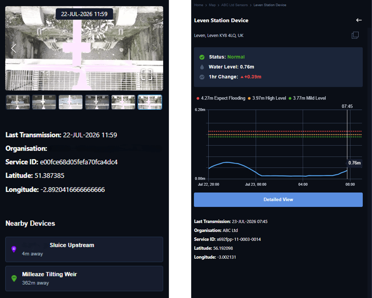
Managed IoT radar sensors and cameras on drainage, rivers, tidal systems, culverts and wastewater assets feed real-time ground-truth data back into the forecast. An alert grounded in what is actually happening on site, giving a signal when the forecast turns into an event that is actually unfolding.
- Real-time ground-truth verification
- Precise, asset-level targeting
- Resources deployed where they matter
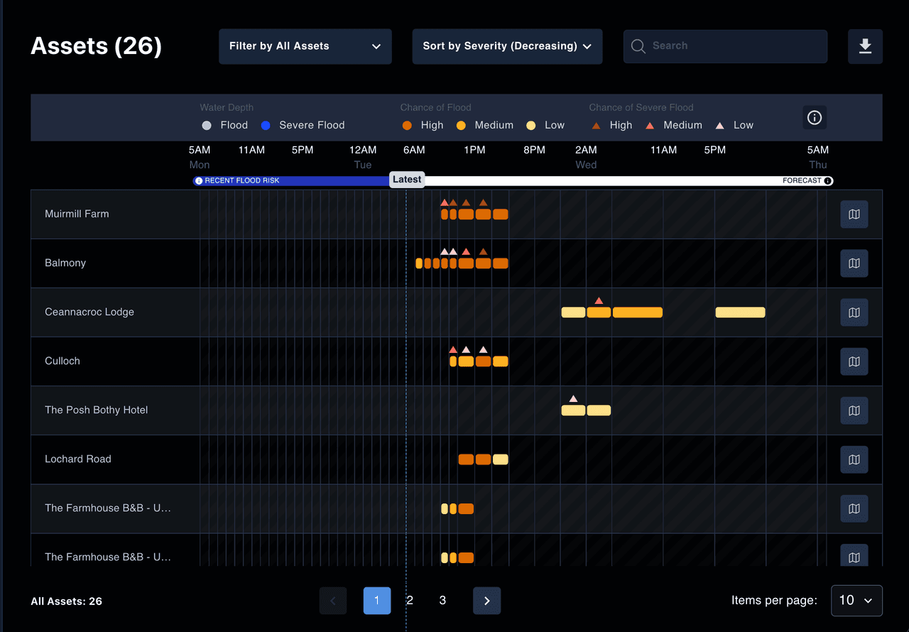
Write riskier locations with smarter terms.
Portfolio-wide, per-asset severity ranking sits alongside retrospective event footprints, turning a static risk score into evidence-based risk engineering. Underwrite complex or higher-risk sites with confidence instead of blanket exclusions, and back renewal conversations with a live picture of exposure across the book.
- A renewal and retention lever
- Deeper client relationships
- Evidence-based risk engineering guidance
Working with Liberty Specialty Markets to mitigate flood impacts for their clients.
Previsico's technology allows us to use data intelligently and integrate it seamlessly into our risk management portal for customers. This provides very real value to our insureds.”
Common questions from insurers
Straight answers to the questions underwriting and risk-engineering teams ask most before bringing Previsico into their book.
Catastrophe models and long-term risk maps price and reserve; they can't tell you which asset will flood on Thursday. Previsico is operational: property-level, 48-hour, hourly-refreshed alerts your policyholders act on to cut the loss, not just estimate it.
Yes. Surface water is the majority of UK flooding and where losses often land. Free government flood warnings cover river and coastal flooding only; Previsico's live hydrodynamic modelling adds property-level surface-water alerts on top.
By email, text message and through the dashboard, and via partner portals such as an insurer's own risk-management portal. Alerts arrive up to 48 hours ahead with likelihood, severity and timing per asset.
No. It sits alongside your existing process: retrospective event footprints and property-level data inform terms and risk-engineering guidance without replacing your models or systems.
It gives you a tangible, proactive risk-partner story, advance alerts clients can act on, that defends renewals and supports risk-informed conversations rather than blanket exclusions.
Yes. Our Lloyd's Lab preventability framework assessed real Lloyd's loss data and found actionable alerts covered 96% of observed flooding, with losses cut by 50% or more when combined with a flood plan and resilience measures.
Still have questions?
See flood losses before they hit your properties.
Book a demo and we'll map your flood-exposed portfolio on the platform.