
 Maddy MaguireNews & insights
Storms Austen and Boelo: how Previsico alerted 33 organisations in one weekend
Storm Austen, the first named storm of the 2026/27 season, hit southern England on Friday 23 October. Over the weekend of 23–25 October, Previsico alerted 33 organisations that their sites were at risk of flooding.
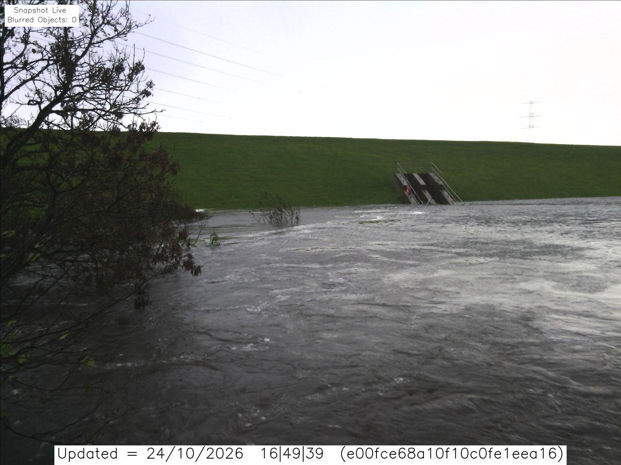
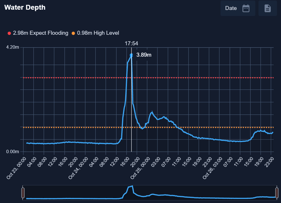
In the space of two hours on Saturday 24 October, a river in Kilbirnie, North Ayrshire, went from fast-flooding to spilling across its banks. Previsico's sensors there recorded a rise of around 3.5m as Storm Boelo arrived, and our on-site camera captured it frame by frame.
That is how quickly flooding can happen and why warning time matters.
Over the weekend of 23–25 October, Previsico alerted 33 organisations that their sites were at risk of flooding.
Storm Austen, the first named storm of the 2026/27 season, hit southern England on Friday 23 October, with an amber warning for Cornwall and parts of Devon. Storm Boelo followed on Saturday 24 October, bringing an amber wind warning to Scotland and heavy rain across northern England.
Together they gave England the wettest week since October 2024: an average of 55mm of rain in seven days, rising to 76mm in the North West and 87mm in the South West, according to the Environment Agency (ITV News).
Much of that rain fell on ground still parched by drought, with parts of the South West in severe drought. Dry, hardened soil absorbs water slowly, so more of it runs off the surface, which is exactly the setup for surface water flooding.
Here is what our forecasting and on-site monitoring showed, as it happened.
The forecast matched the flooding
Our probabilistic flood forecasting (PFF) pinpointed flood risk at street level on the days that mattered, in the places where flooding was later reported.
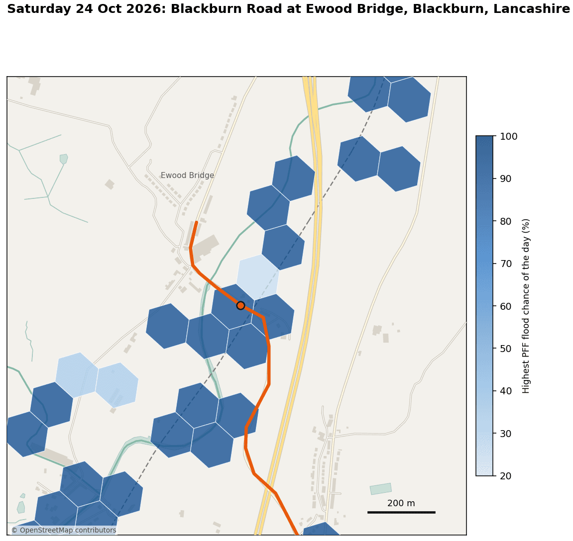
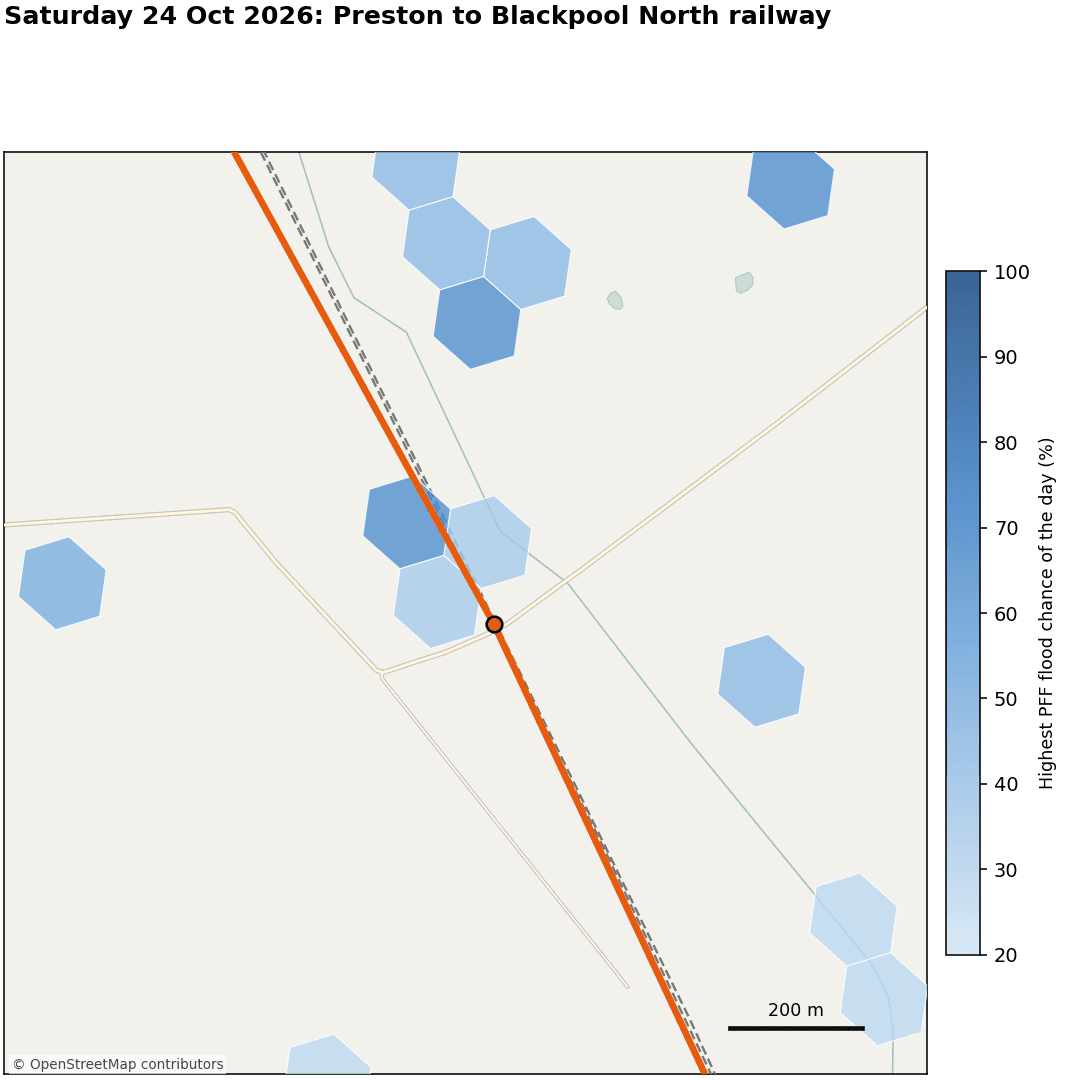
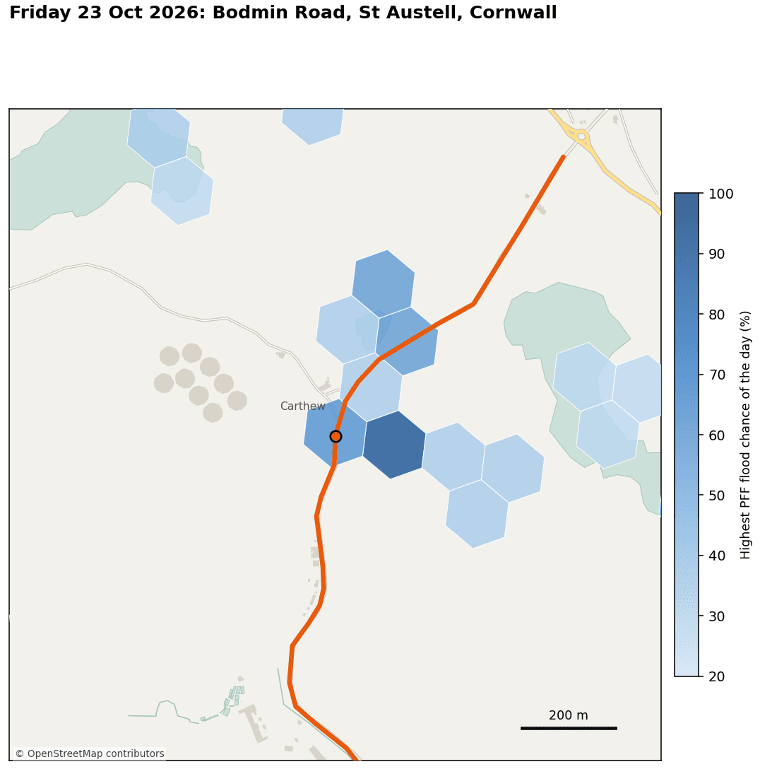
PFF runs our hydrodynamic model, built on two decades of research as Loughborough University, across more than 200 rainfall scenarios. The share of scenarios that produce flooding gives the chance of flooding at each location. On the maps below, each hexagon shows the highest chance of flooding forecast for that day, from 20% (pale blue) to 100% (dark blue).
Ewood Bridge, Rossendale
On Saturday 24 October, as Storm Boelo moved through, PFF showed a cluster of cells at 85-90% along the River Irwell, on both sides of Blackburn Road. That day, the road flooded at its bridge over the Irwell after heavy rain (Oldham Times).
Preston to Blackpool North line
Also on Saturday 24 October, PFF showed 40–65% cells beside the Preston to Blackpool North railway and at a road crossing on the line. Flooding then blocked the line, cancelling and delaying trains (Beinsure).
Bodmin Road, St Austell
On Friday 23 October, during Storm Austen, PFF showed a cell above 85% right next to Bodmin Road at Carthew, with 50–65% cells along the route. By early morning, Devon and Cornwall Police had closed the road due to flooding (Cornwall Council).
For an insurer, a rail operator or a facilities team, that's the difference between a general weather warning and knowing exactly where to act: which property, which stretch of track, which site.
On the ground, the sensors told the same story
As both storms passed, our water level sensors recorded every rise and fall as it happened.
Forecasts show where flooding is likely but sensors show what is actually happening. Through both storms, ours reported water levels continuously, and in North Ayrshire and Essex, they rose past alert thresholds, sending warnings straight to the teams on the ground.
Kilbirnie, North Ayrshire
Our river sensor at Kilbirnie held steady until the afternoon of Saturday 24 October. Then, as Storm Boleo arrived, the level rose by around 3.5m in a matter of hours. It passed the high-level threshold and well beyond the "expect flooding" line before falling back overnight. A second, smaller rise followed on 25 October.
Braintree, Essex
Our sensor at Hoppit Bridge normally reads around 700mm. It crossed its alert threshold of roughly 950mm twice: briefly with Storm Austen on 23 October, then for longer as Storm Boelo's rain arrived late on 24 October. It peaked at around 1,100mm before easing on 25 October.
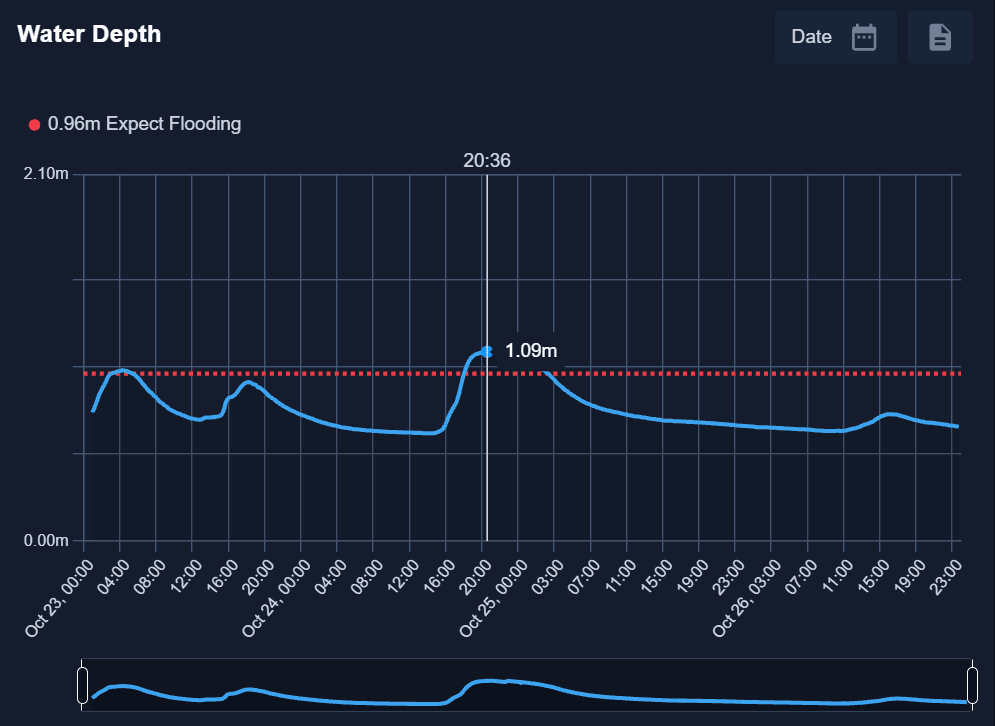
Every reading appears on the client dashboard as it happens, and the moment a level crosses its threshold, an alert goes out by email and text, so the people responsible know before the water reaches them.
The two hours at Kilbirnie
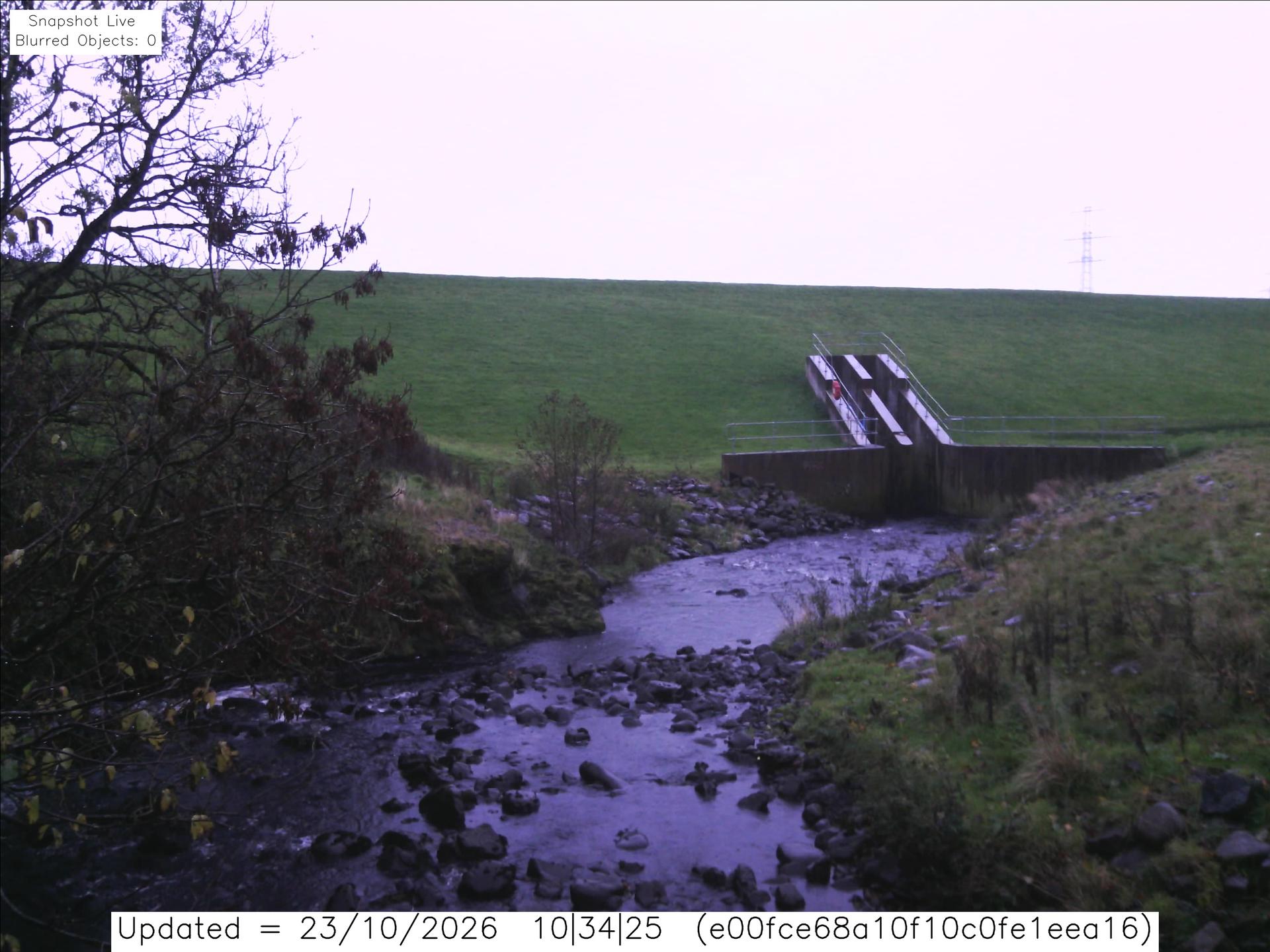
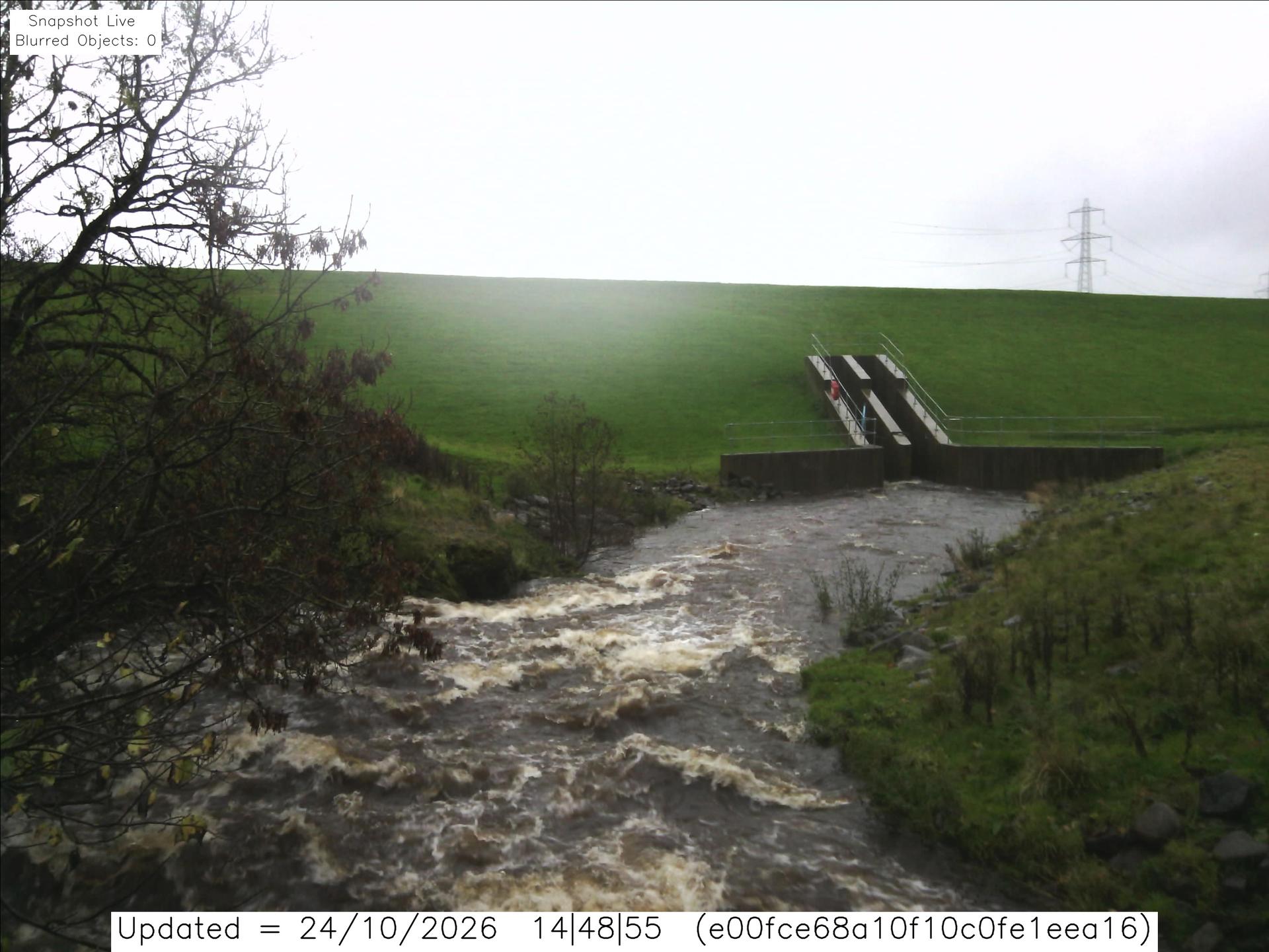
Our on-site camera at Kilbirnie captured the same event the sensor recorded, showing the river rise frame by frame as Storm Boelo arrived.
Friday 23 October, 10:34
Normal conditions: a shallow, rocky channel below the embankment outlet.
Saturday 24 October, 14:48
Fast, brown, churning water fills the channel as the sensor level starts to climb.
Saturday 24 October, 16:49
The channel has disappeared under a wide sheet of floodwater, and the outlet structure is almost submerged
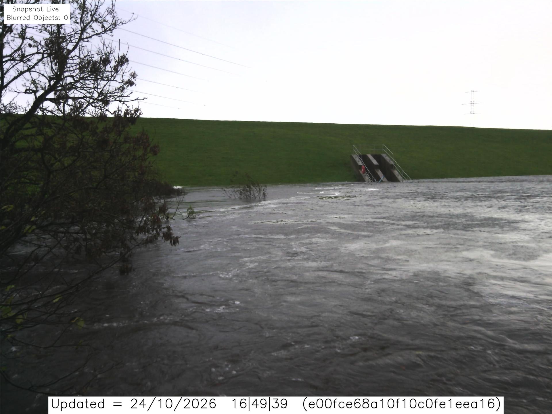
In the two hours between the last two images, a fast-flowing river became a sheet of floodwater, matching the sharp spike on the sensor graph. The sensor measures how fast the water is rising; the camera shows what that looks on the ground.
At that speed, there is no time to work out a plan once the water starts rising. Whatever a site team is going to do, whether moving stock, closing access or deploying defences, has to be decided before the first frame looks anything like the last.
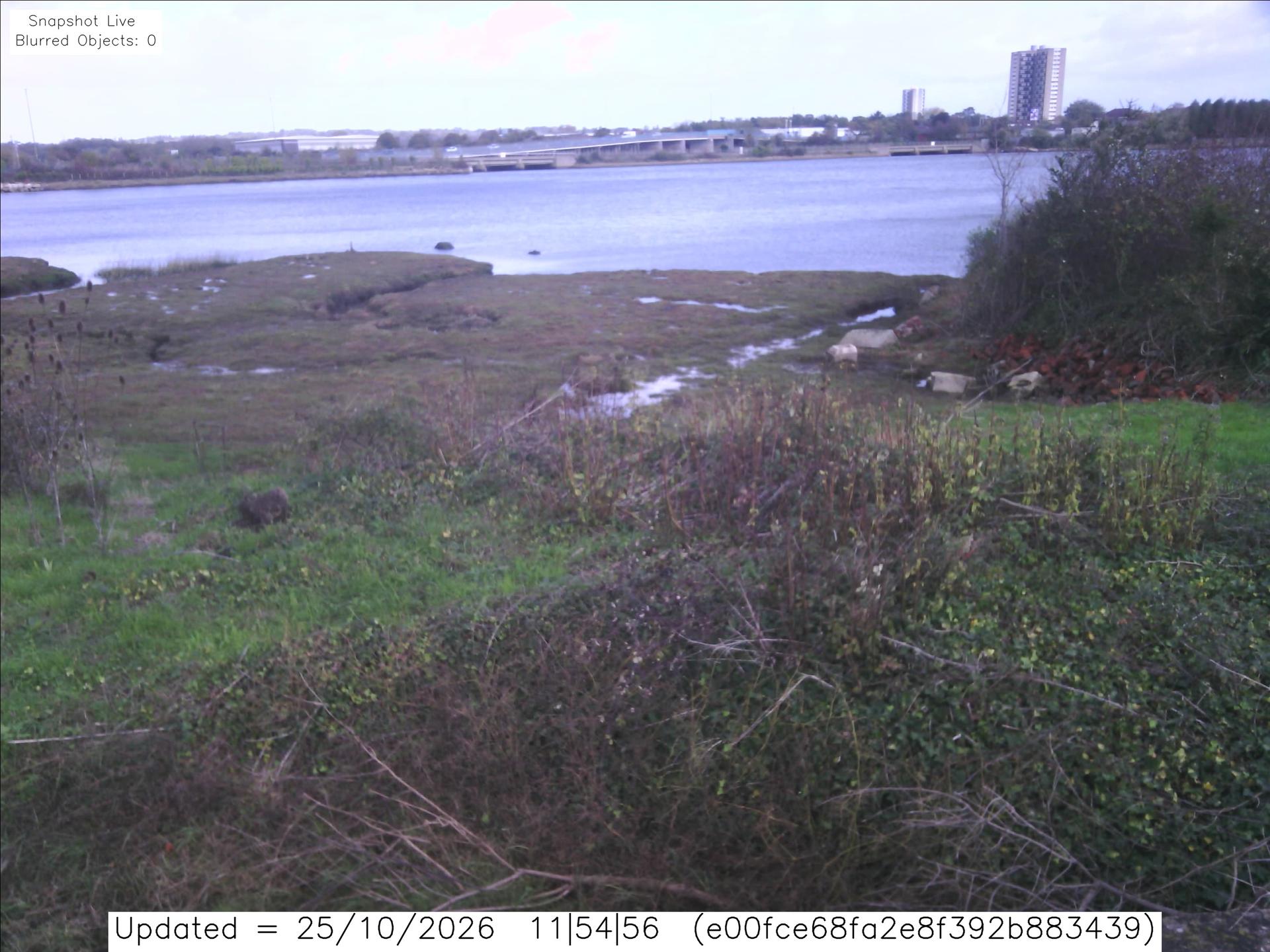
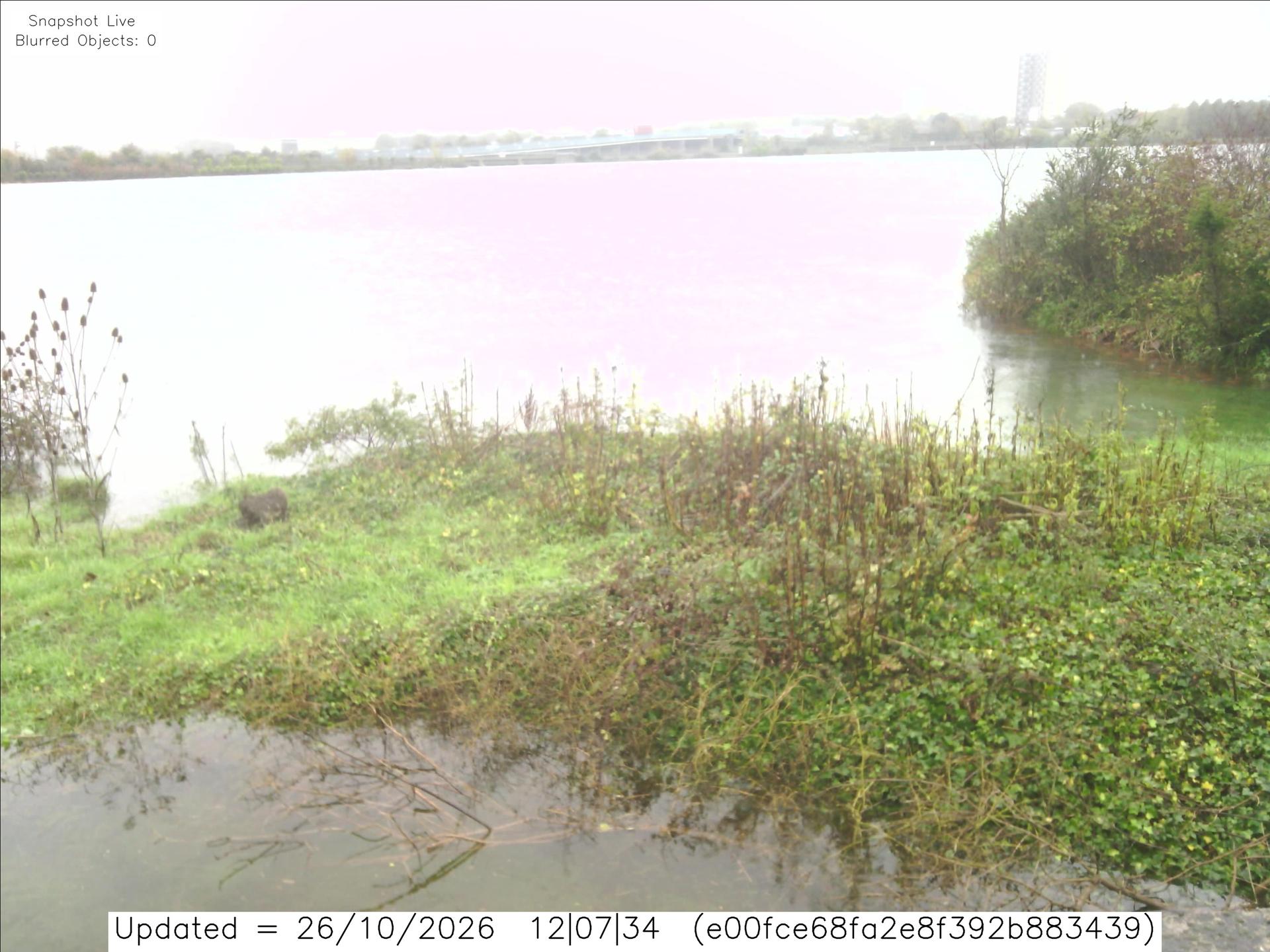
A second camera, at a tidal estuary site, showed a similar pattern on 25 and 26 October: saltmarsh exposed one day, and the next, water across the marsh and pooling on the bank.
Austen and Boelo were the first but they won't be the last.
The season has only just started, and the ground is already wet. Saturated soils and high rivers mean the next storm needs less rain to cause flooding.
When water can rise 3.5m in an afternoon, the warning is the response window. The 33 organisations we alerted had time to move stock, protect equipment, reroute staff and warn customers before the water arrived. That is what actionable flood intelligence looks like:
- Site-level forecasts that show which assets are at risk, not just which region
- Real-time sensor data that confirms what is happening as levels rise
- Live camera images that show the situation on the ground without sending anyone out
If your sites, portfolio or policyholders sit in the path of the next named storm, now is the time to get set up, not when the warnings are already out.
Talk to our team about protecting your assets before the next storm.
Request a demo enquiry
Maddy Maguire
Junior Customer Success Associate