
For Construction
Build with confidence, whatever the weather.
Avoid project delays, protect on-site teams and reduce damage to plant and materials, with 48-hour, site-specific flood forecasting and live monitoring tailored to your exact site boundaries.
See your site boundary on the platform. No obligation.
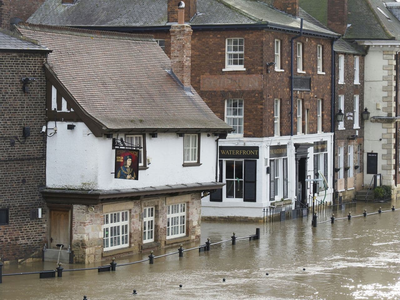
Built on the science
Two decades of Loughborough research, trusted on major UK build sites.


The challenge on site
Generic weather warnings don't reflect your site, or your programme.
Surface-water flooding shuts the site
Unpredictable weather disrupts access roads, compounds and critical works, leading to shutdowns, delays and programme overruns, with generic Met Office / EA warnings that don't reflect actual site risk.
Downtime is expensive, and delays carry penalties
Idle plant hire and labour, plus contractual penalties for delays, make every avoidable shutdown costly.
Go / no-go decisions are hard to call with confidence
Ahead of a storm, site managers lack site-specific insight, and operative health and safety is on the line during extreme weather.
Two technologies, one confident call
Confident decisions, built around your exact site.
Flood forecasting and live monitoring work together to give site managers 48-hour, site-specific warnings, so you can plan around disruption, protect plant and materials, and reduce risk to operatives, whatever the weather does.
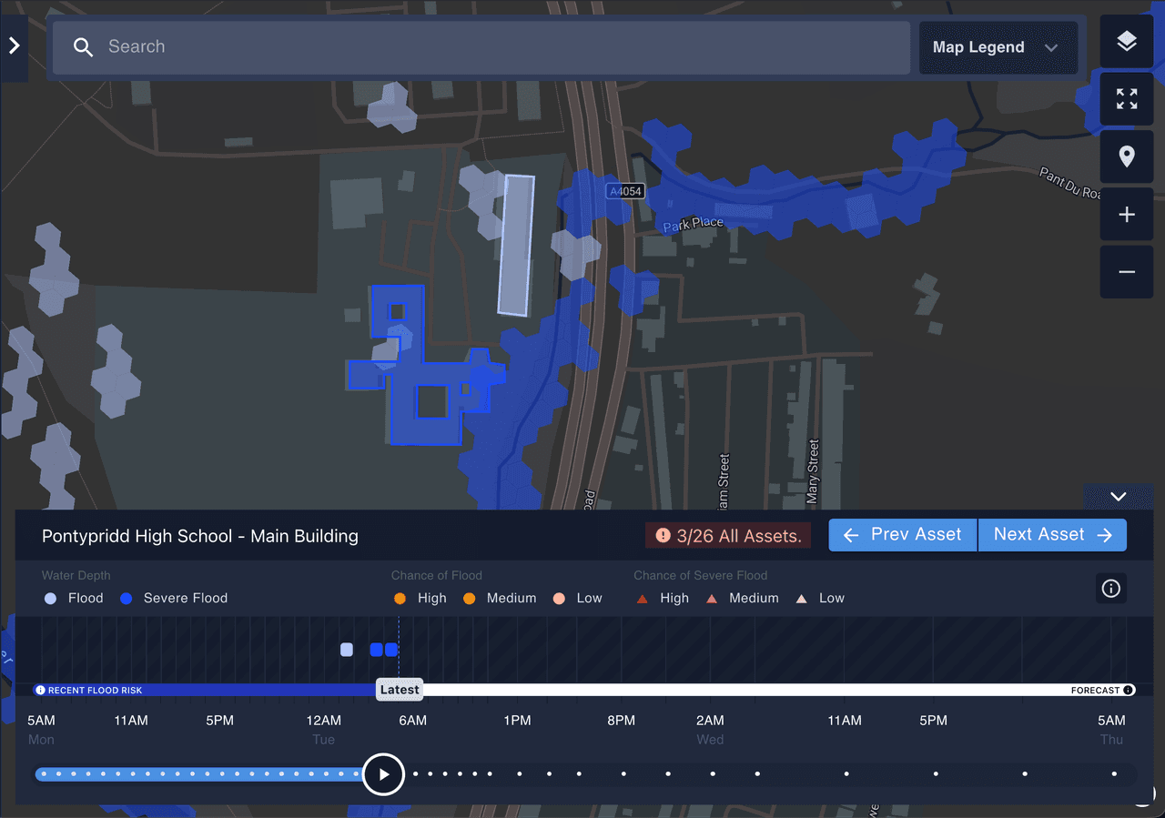
48-hour, site-specific flood warnings.
Live hydrodynamic modelling forecasts surface-water flooding up to 48 hours ahead, tailored to your exact site boundaries, not a regional zone. Warnings that reflect your site, so you can plan around disruption instead of reacting and keep the programme on track.
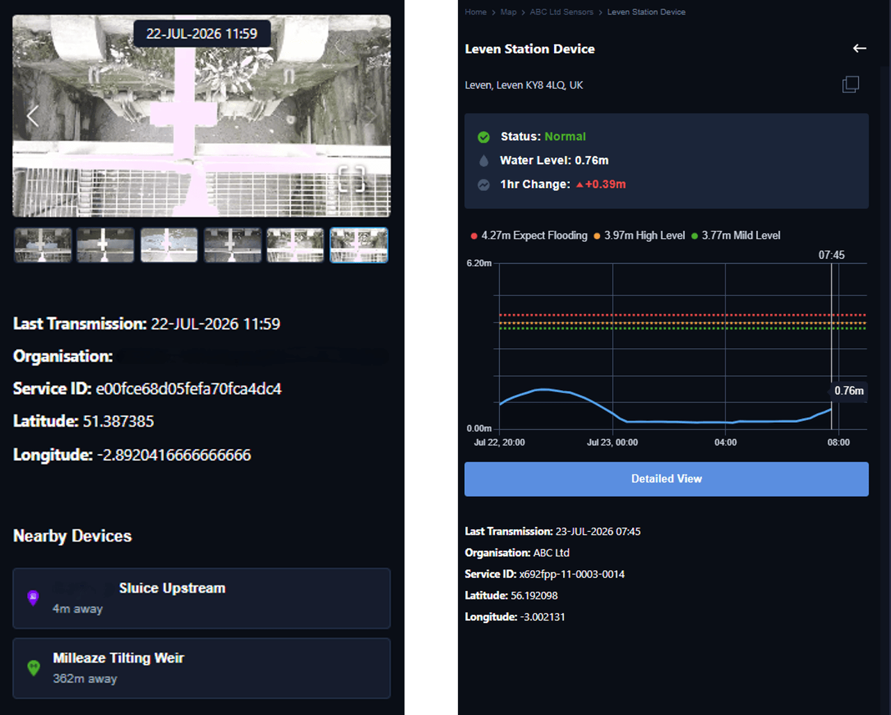
Real-time water levels on your compound.
Managed radar sensors and cameras monitor ordinary watercourses, drainage and culverts around the compound, tracking water levels against flood thresholds in real time. Ground-truth data to protect plant, materials and access, and reduce risk to operatives during extreme weather.
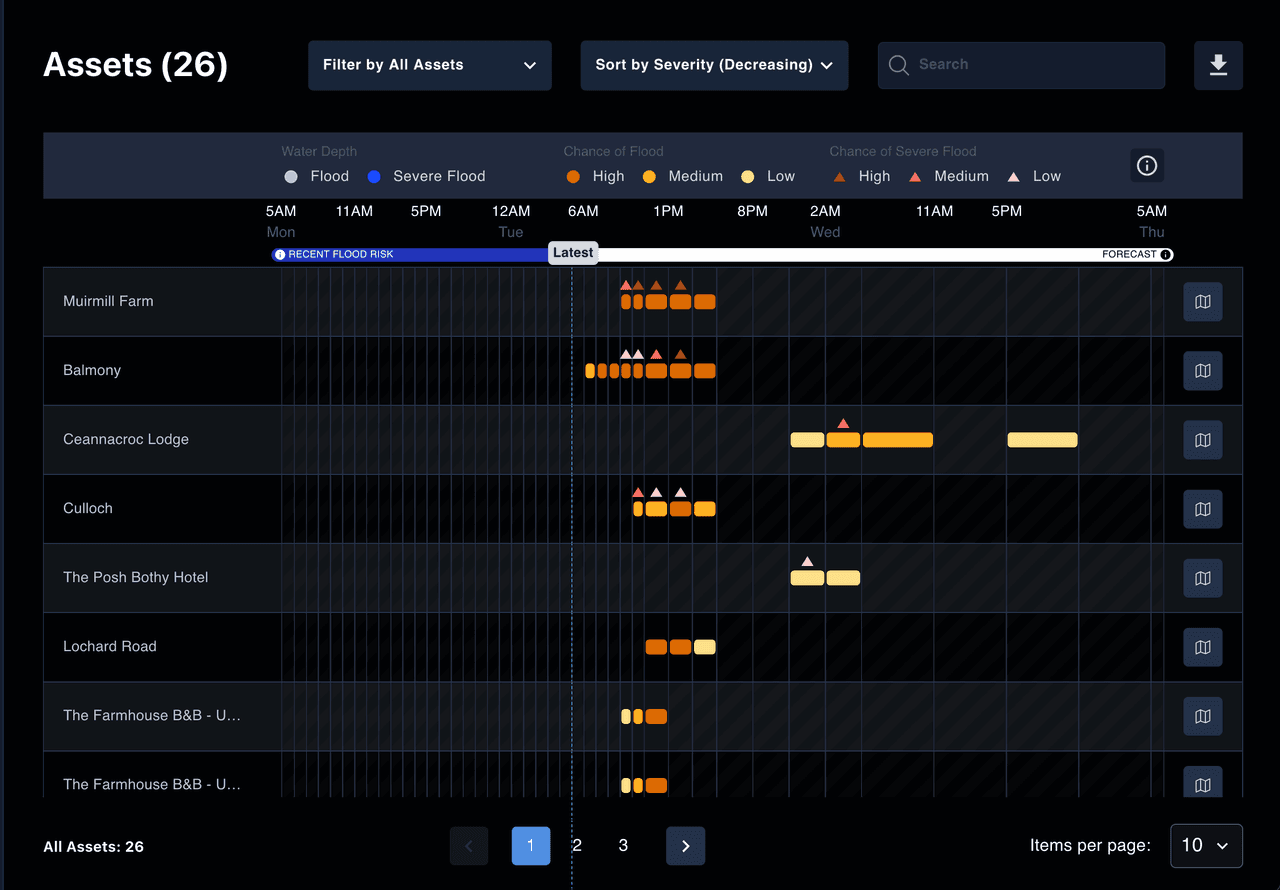
Clear, actionable warnings for site managers.
Clear, actionable warnings give site managers the evidence to make confident go or no-go calls ahead of a storm, not after it. Fewer shutdowns, avoided damage, delays and contractual penalties, and the programme certainty to keep the build on track.
See the technologyMonitoring watercourse levels on a major viaduct build.
“On a major UK viaduct project, the delivery joint venture used the Previsico Flood Intel Platform to monitor water levels along the ordinary watercourse at the site, turning live readings into confident decisions before water threatened works.”
Questions from site managers and project teams
Straight answers about site-specific forecasting, live monitoring and go/no-go decisions.
Those are regional and generic; they don't reflect your site. Previsico forecasts surface-water flooding 48 hours ahead tailored to your exact site boundaries, so warnings match the risk on the ground.
Yes. Clear, site-specific warnings up to 48 hours ahead let site managers plan around disruption and make confident go/no-go calls before a storm rather than reacting to it.
Yes. Live monitoring of watercourses, drainage and culverts around the compound gives real-time water levels against flood thresholds, so you can move plant and materials in time and reduce damage.
Yes, surface water is the majority of UK flooding and the main cause of site disruption. free government flood warnings cover river and coastal only; Previsico adds site-specific surface-water forecasting.
Managed sensors and cameras are installed at the watercourses and assets that matter to the site, and forecasting is configured to your site boundary, so monitoring reflects your compound from the start.
Still have questions?
Talk to our team about mapping your site boundary and getting 48-hour, site-specific warnings.
Keep the programme on track through the storm.
Book a demo and we'll map flood risk to your exact site boundary.