How Previsico's hindcast data predicted the extend of South Florida's flooding after Hurricane Darren
- Written by
 Dr Vivian Camacho
- Published
- September 5, 2024
- $100mEstimated losses in Florida
- 8 millionResidents impacted in Florida
In June 2024, more than 8 million (1) residents were impacted by significant flooding in South Florida due to Hurricane Darren.
The area experienced a trough of low pressure over the eastern Gulf of Mexico and was soon designated by The National Hurricane Center as an Invest 90L, which refers to an area that is being monitored for potential cyclone development.
The hurricane brought with it significant rainfall, leading to severe flooding across several counties in South Florida. In response to this flooding, a State of Emergency was declared in Broward, Collier, Lee, Miami-Dade and Sarasota counties - all located within the South Florida region - on the 13th of June 2024.
After days of significant rainfall and flash flooding, insurers were predicting losses to be over $100 million. (2)
In this event review we use our modelling tools and data to understand and identify how storm rainfall data can predict and mitigate large flooding events.
We also look at how our insights helped validate claims, creating efficiencies for our customers’ triage practices and improving their overall claims processes.
The analysis
The product development and modelling team at Previsico undertook a hindcasting exercise, covering the period between midnight of 12th June 2024 to midnight of 14th June 2024 to Provide crucial analytics to support our customer’s event response.
Hindcasting refers to the process of using rainfall observations, instead of rainfall forecasts, to run Previsico’s flood model. By using rainfall radar observations, it provides flood depth outputs that are more accurate.
Post-event analysis was undertaken based on hindcasting and reported flooding (3) and we focused on the impacts of flooding on transport network. The image below provides an overview of the basins covered by the hindcasting; areas affected.
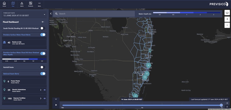
Hindcasting Results
To validate the flood modelling depths, flood records from news sources (3,4) were collected. These locations included the sites: North Bay Road in Sunny Isles Beach, Hallendale Beach, Hollywood South Florida and Aventura to Miami Railway line. Out of these locations, the model results show flooding for all of them as you can see in the examples below:
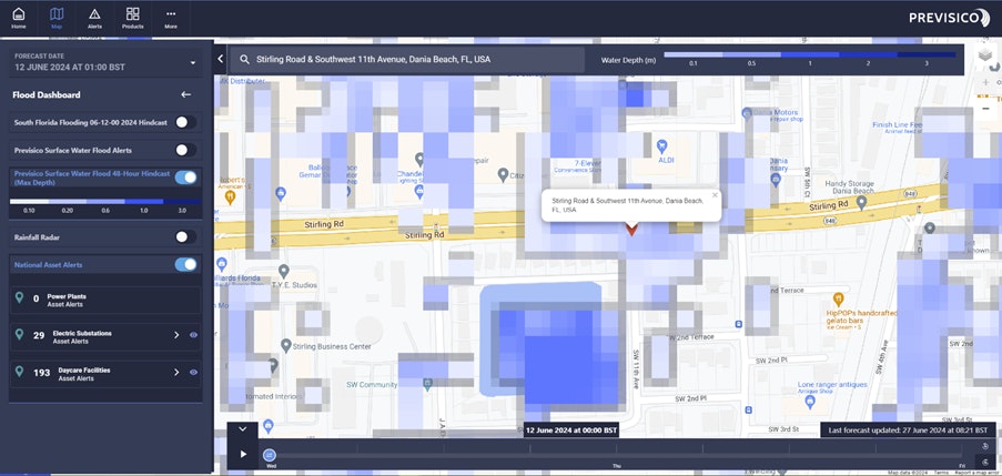
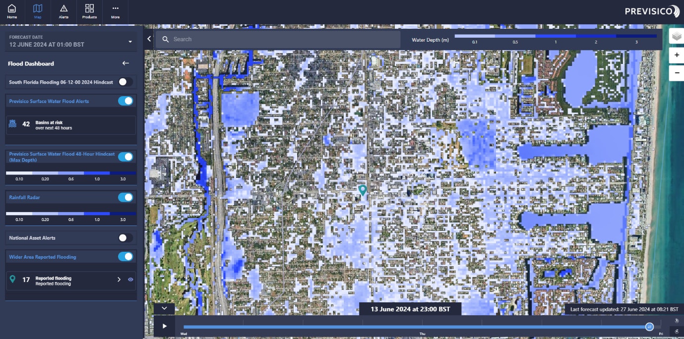
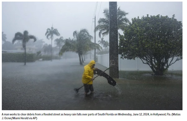
Roads: According to Florida Division of Emergency Management (3), Stirling Road at SW 11th Ave suffered from flooding on its turning lanes. This agrees well with Previsico’s hindcasting which shows water depth reached ~20 inches at the peak of the flooding. Our hindcast also highlighted flooding in Hollywood, South Florida which can be seen on our dashboard below with onsite pictures of the flooding.
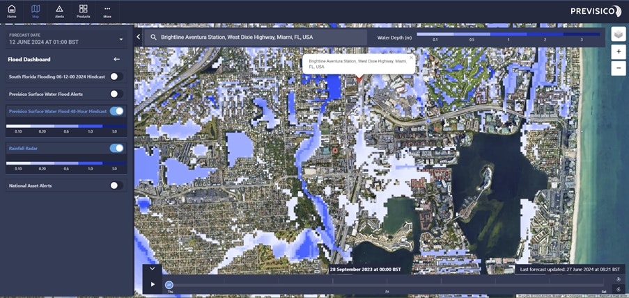
Rail: It was reported (3) that the operations were suspended from Aventura and Miami Station on Brightline due to flooding. Previsico’s hindcast picked up multiple sections of the railway lines flooded between these two stations.
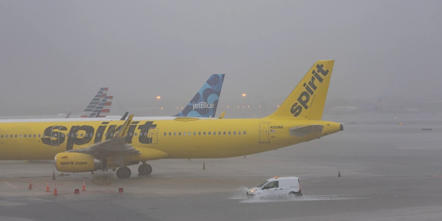
Airport: At Fort Lauderdale/Hollywood International, several taxiways were closed due to flooding. More than 50 commercial flights were delayed and cancelled. Previsico’s hindcasting shows that the airport was widely affected by flooding, both internally and in the surrounding areas where access roads were affected.
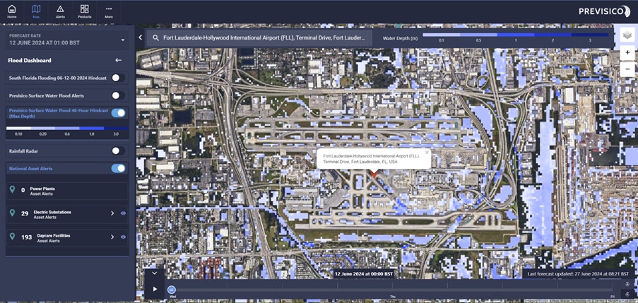
Overall, 17 points/areas were extracted from news sources, four of these flooding events have been demonstrated in this review that have affected the transport network.
Other areas shown in Previsico’s post-event analysis using our stormwater flood model and observed rainfall data included the neighbourhoods of North Bay Road in Sunny Isles Beach and Hallendale Beach.
Outcome
Our hindcasting data was able to mirror the flooding that actually occurred in areas of South Florida that were impacted by Hurricane Darren. Over the course of several days, flooding caused significant damage resulting in over $100million worth of losses (1).
The purpose of this review was to see if using observed rainfall data to run our flood model would provide more accurate flood depth outputs compared to just rainfall forecasts. Our data was able to capture the flood outcome for all 17 areas monitored, and demonstrated that the model produced accurate data for flooding of the transport network, specifically.
This data was passed on to a customer who found that it significantly improved their claims processes. By being able to pinpoint these 17 areas and the flooding impact, they were able to effectively triage claims. It led to a smoother, quicker and more streamlined claims process.
This review has highlighted the multitude of ways that stormwater flooding can impact people and organisations such as flooded residential homes, businesses closing their doors, delayed and cancelled flights and cancelled trains. Having an early warning and access to real-time data would allow for residents to evacuate and move valuable items from risk, businesses can take action to ensure they don’t suffer significant business interruption, and the rail and air networks can be proactive in their decision making to manage public liability as well as flood risk.
References
(1) https://www.bbc.co.uk/news/videos/cp998wjy9pro
(2) https://news.ambest.com/newscontent.aspx?refnum=258512&altsrc=23
(4) Frisaro, F., Spencer, T., & Kozin, D. (2024, June 14). Tropical rainstorms in South Florida lead to flight delays and streets jammed with stalled cars. AP News. https://apnews.com/article/tropical-rainstorms-south-florida-flooding-2024
(5) Sun Sentinel. (2024, June 12). Heavy rain sets off flash flooding in South Florida, stranding drivers, delaying flights. Sun Sentinel1
(6) https://apnews.com/article/rain-florida-flooding-hurricane-season-bb31b2d8ac01ee1300642ce674c6e61c
(7) Fox Weather, June 13 2024. Harrowing images show Fort Lauderdale airport flooded as over a foot of rain blasts Florida. https://nypost.com/2024/06/13/us-news/fort-lauderdale-airport-floods-as-over-a-foot-of-rain-blasts-florida/