Prepare
Stay ahead of events using actionable flood forecasts and hydrological monitoring (including drainage).
The tools you need to prepare and take action to prevent flood impacts.
Stay ahead of events using actionable flood forecasts and hydrological monitoring (including drainage).
Mitigate impacts using flood nowcasts and real-time risk monitoring.
Prevent flood impacts by proactively maintaining your assets with hydrological insights.
Three core services, combined into one powerful, easy-to-use tool.
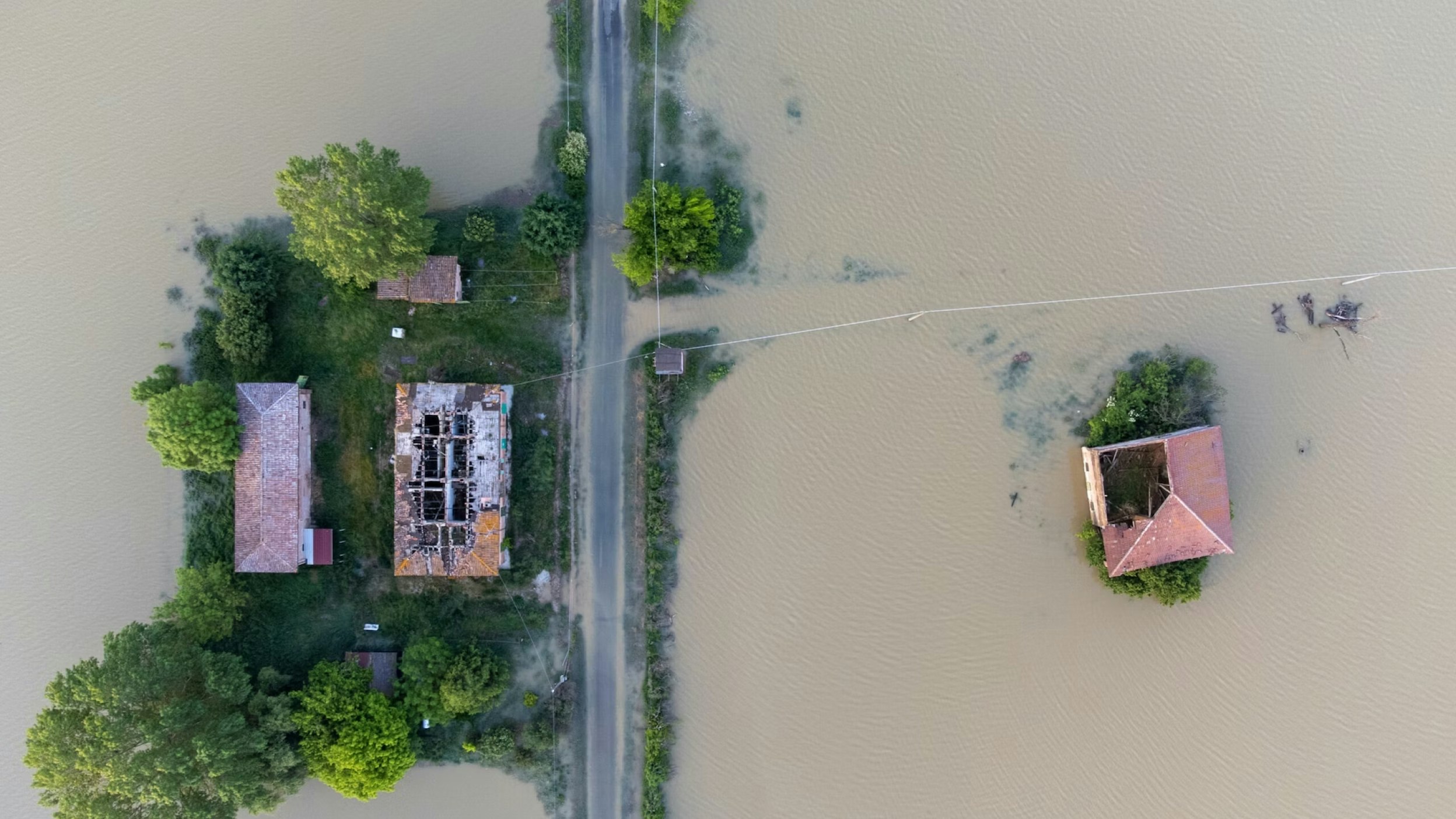
The only platform of its kind, Previsico's solution is driven by a growing need to prevent stormwater flooding from catching people off guard. The world's most advanced technologies, brought together to protect home, businesses and entire communities across the globe.
Leveraging existing sensor data and bespoke models to:
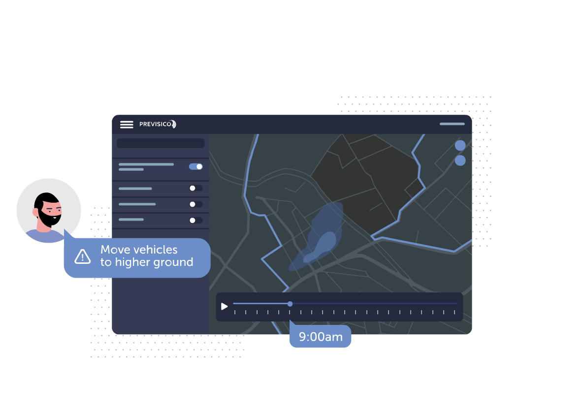
Interactive map displays the forecasted time and depth of your property/assets' flood risk. Customers can view live sensor analytics to monitor actual flood risk and on-site sensor performance.
Real-time asset risk scoring provides real-time risk scores for your assets.
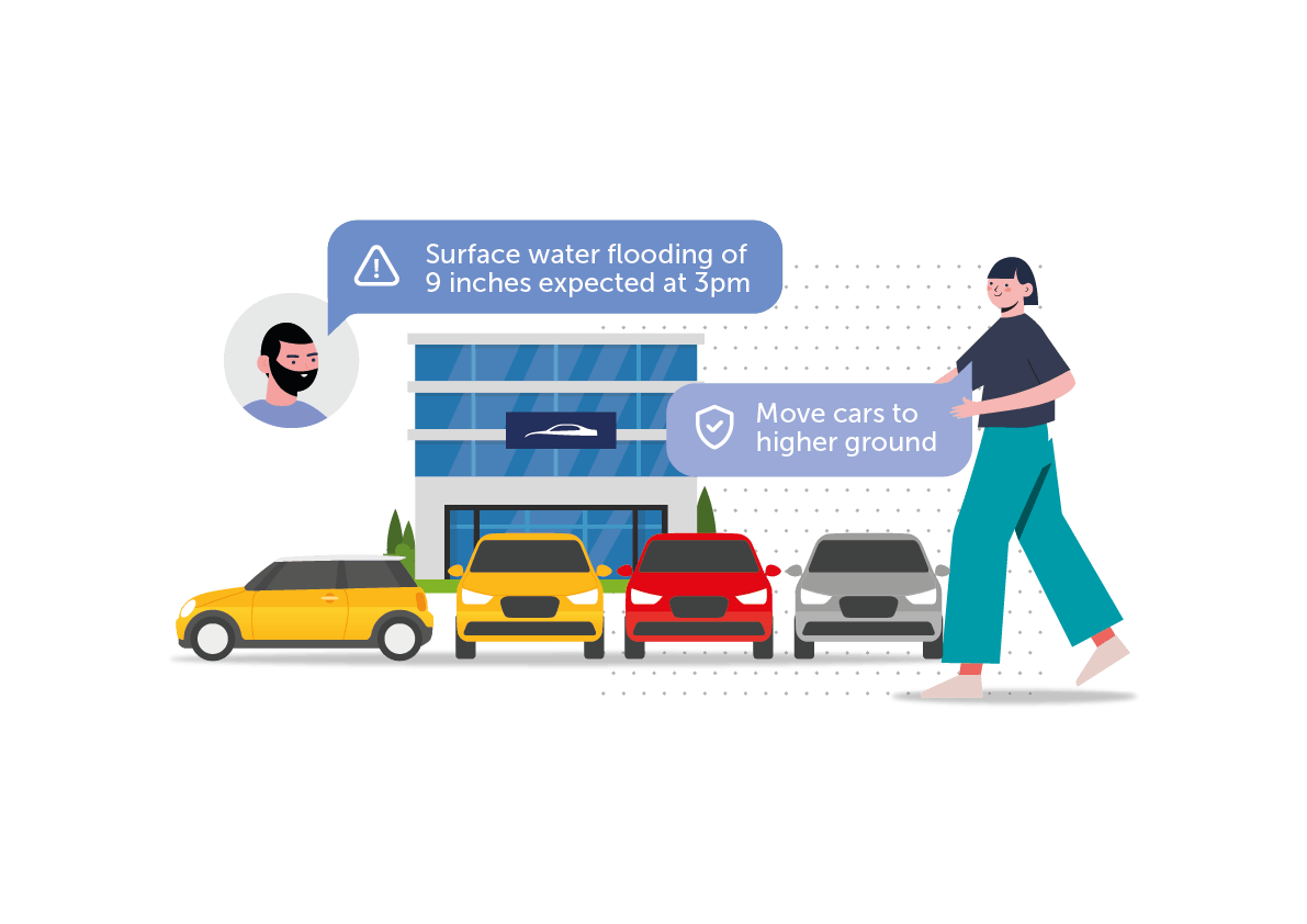
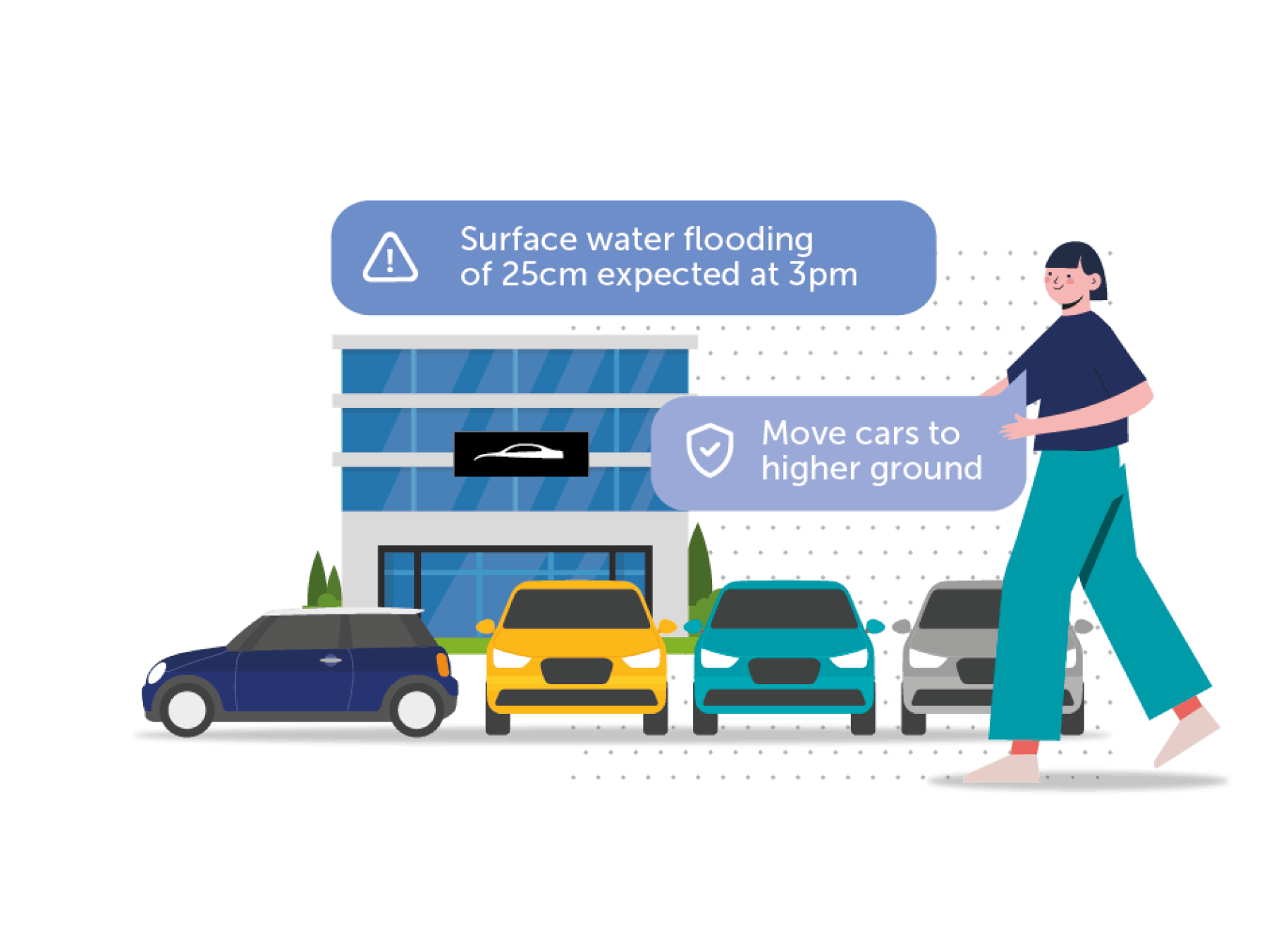
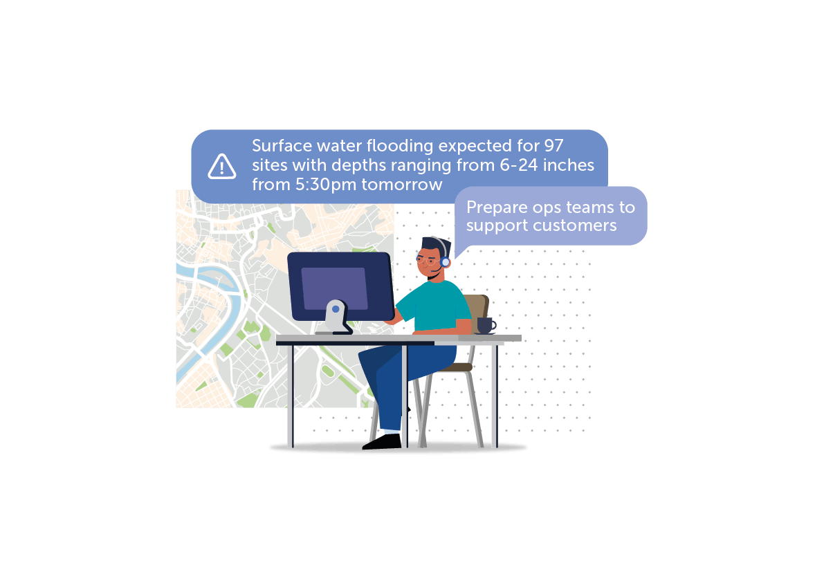
Immediate notifications up to 48 hours in advance to enable you to proactively manage flood risk.
Warnings can cover both property point locations and wider areas (polygons) that highlight forecasted depth, time and duration of flooding as well as critical sensor threshold.
Integrated data from our Flood Intel Platform feeds into your own risk management tool via API for an centralized, easy view of risk.
All data feeds are available via API (point, polygon and mapping data).
Our forecasting system continuously generates flood forecasts at the property level, taking into consideration the latest weather nowcasts and forecasts and antecedent conditions derived from observed rainfall.
At the core of our forecasting system is a bespoke hydrodynamic modelling suite designed for accurate real-time flood forecasting. The system utilizes the latest cloud computing technology and generates high-resolution property-level forecasts at scale.
The service continuously uniquely re-runs the model all year round, generating event specific forecasts to warn of flooding at property level up to 48 hours in advance.
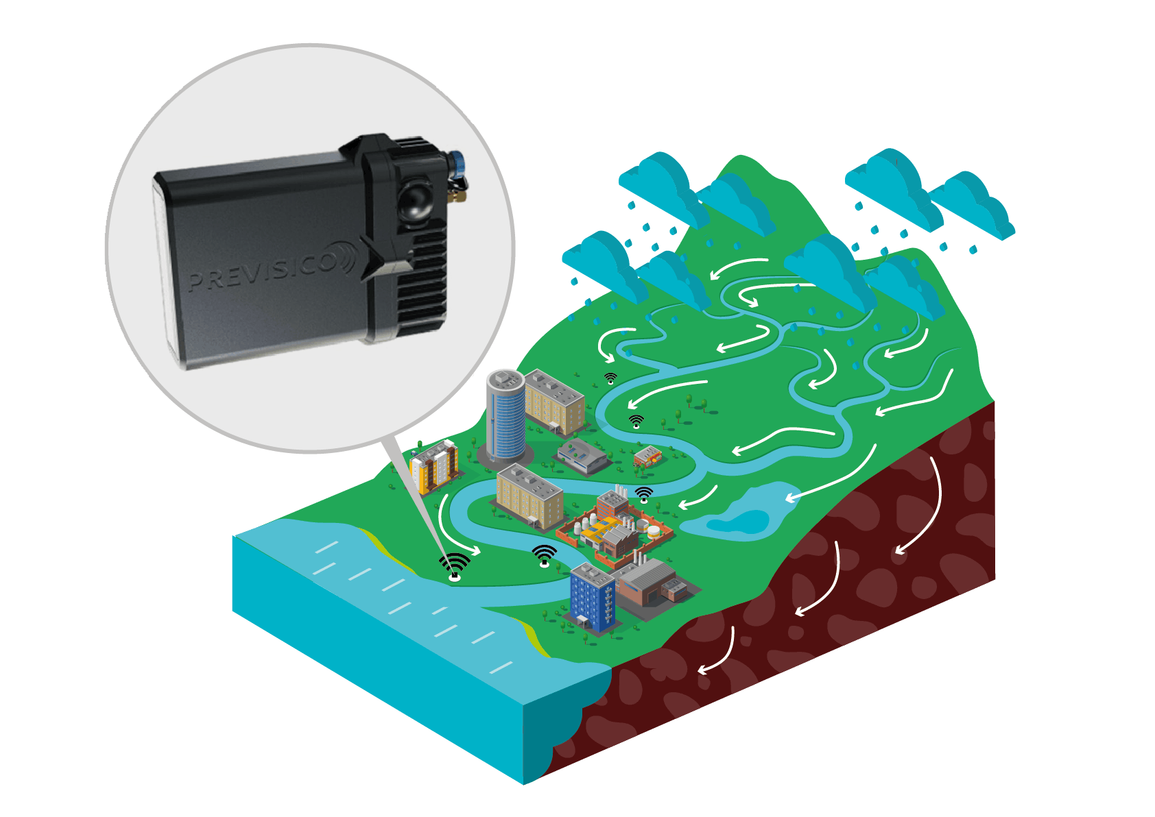
This leverages leading data sources such as hyperlocal rainfall forecasts, sensor derived water levels, antecedent condition, local drainage, topography, land cover, soil and geology to produce fast and accurate representations of flow routing across entire geographies.
The quality of the elevation data used in flood models directly affects the overall accuracy of its results. That’s why we use the best available elevation data which is typically derived from LiDAR in Europe and the USA. We then process this data using a unique proprietary approach to ensuring hydrological connectivity and local features are factored in.
We select rainfall data based on the best local performance with current providers including IBM’s Weather Company.
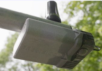
We use an easy-fit, radar-base connected depth sensor that can be installed in a variety of above and below-ground locations. This provides, continuous monitoring and full diagnostics with each reading, meaning data can be verified in real time. Water levels detected from the sensors feeds into our live modelling to ensure local conditions are captured in each forecast.
We incorporate drainage maps and sensor data into our model and offers clients the ability to share their knowledge and experience of flood so that appropriate adjustments are made if drainage networks in an area do not perform as expected. We continuously update drainage conditions ahead of each run with hundreds of thousands of unique data points already factored in.
We account for the antecedent conditions of an event and is able to simulate flood forecasts incorporating into our model the rainfall and the ground conditions preceding the event and by adjusting accordingly the parameters affected by wetness including drainage capacity and hydraulic conductivity. A full article outlining the process is here.
We use a combination of global and national land use, land cover, soil and geology maps as well as satellite imagery to parameterize the software.
We use state-of-the-art easy-fit, connected hydrological sensors (e.g. level, velocity) uniquely designed for real-time monitoring of different hazards, including rapid-onset events occurring above (e.g. riverine, coastal and intertidal environments; screened culverts) or below ground (e.g. stormwater and wastewater drainage networks).
The need to regularly change batteries and/or calibrate sensors when sampling in real-time and at potentially high frequencies over protracted periods renders most commercially available solutions financially unsuitable for long-term monitoring/alerting applications without regular (costly) maintenance. Our technologies overcome these issues, combining Over-The-Air power planning and dynamic sampling to support up to 5+ years battery life, even when submitting data packets at high frequencies.
Enhanced diagnostics are provided with each reading, meaning the data can be verified in real-time, removing the guessing game that currently exists around measurement reliability in environmental monitoring.
This report is a comprehensive review of businesses and organizations’ attitudes to flood risk conducted by Previsico, in partnership with Airmic. Featuring insights drawn from key leaders and professionals, comprising of insurers and the insured in the UK.
The full State of Flood Resilience report is free to download.